
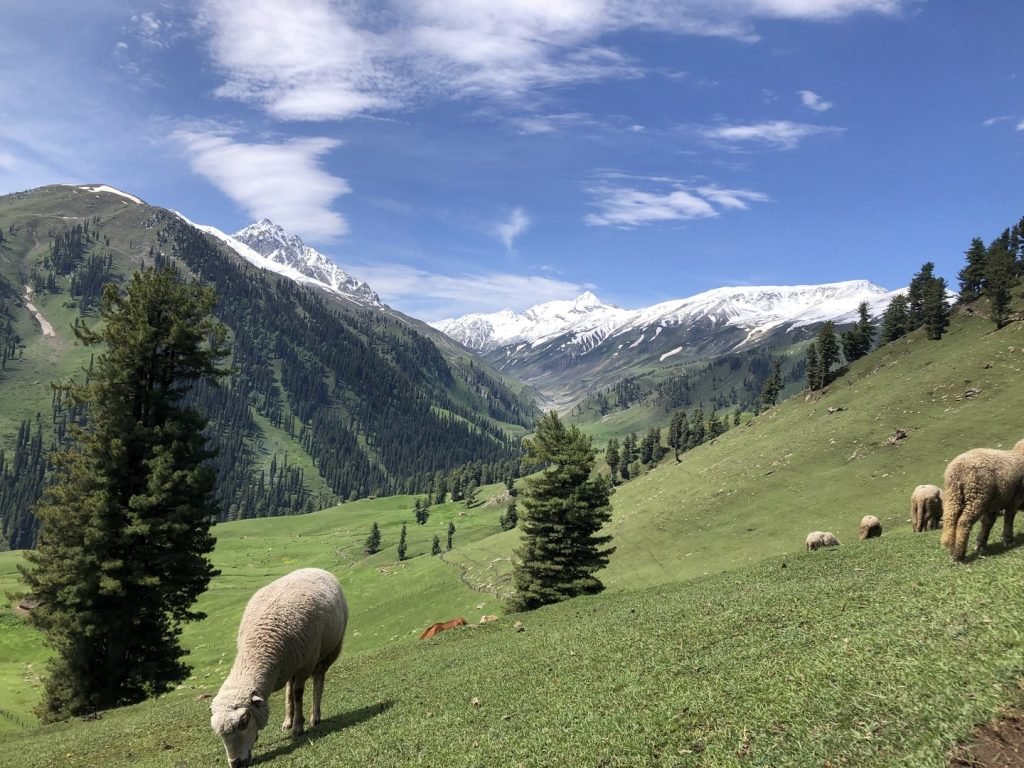
Pir Panjal Range
The Pir Panjal Range runs through the middle of the Kashmir valley and separates it from the rest of the Indian subcontinent. This range is known for its lush green meadows, alpine lakes, dense forests, and snow-capped peaks. The Pir Panjal range is easily accessible and offers a variety of activities such as trekking, skiing, and camping.
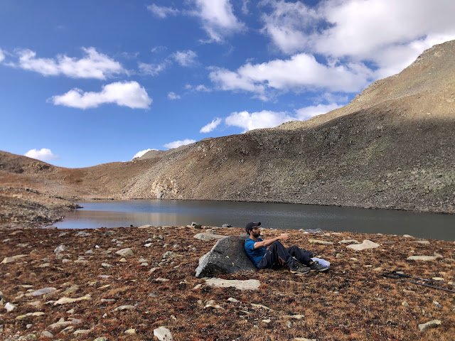
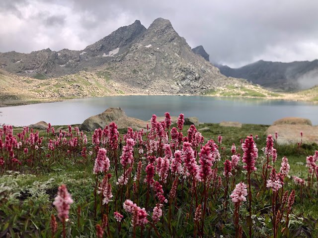
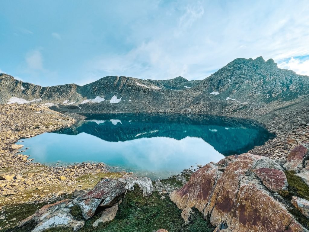
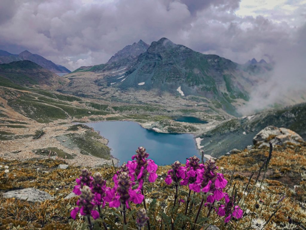
Alpine lakes are a unique feature of the mountainous regions around the world. They are often found in areas where glaciers formed thousands of years ago and have since melted, leaving behind small, pristine lakes that are surrounded by stunning scenery. These lakes are often referred to as “jewels of the mountains” due to their clear waters, amazing colors, and breathtaking views. One of the unique features of alpine lakes is their stunning colors. These colors are due to the presence of natural minerals and organic matter in the water.
The location of alpine lakes is usually at high elevations, often above the tree line. They are usually small, and their sizes range from just a few meters across to several kilometers long. Due to their high altitudes, most of these lakes are frozen for a significant part of the year. They are mostly oligotrophic, meaning they are nutrient-poor and have low biological productivity. They are also surrounded by stunning mountain landscapes, making them popular destinations for hikers, campers, and outdoor enthusiasts. They offer an incredible opportunity for outdoor exploration, stunning photography, and a chance to immerse oneself in the natural world.

This Alpine Lakes Guidebook includes detailed information about the alpine lakes on the Pir Panjal range. For each lake, I will provide information on the best time to visit, how to get there, total distance, elevation gain, and difficulty level.
This will include information on lesser-known alpine lakes that are off the beaten path, but just as stunning. These hidden gems are perfect for those looking for a more secluded and peaceful experience in the mountains. Visitors are advised to follow the Leave No Trace principles to ensure that these precious habitats are preserved for future generations
Kantar Nag
Distance 13kms (one side)
Ascent: 1700m
Start point: Drung Tangmarg.
Difficulty level: Moderate to Difficult
Best time to visit: July to Mid Oct
The trail follows the course of Ferozpur Nalla and after some km comes an army checkpost where you have to show your identity. Then turn west and follow the stream up to Mohandor (3000m). This is a one-day trek for a very fit person but if you want to do it in two days, you can camp at Mohandor. From Mohandor, follow the trail towards the South up to Choringpal (3500m). En route, you will get a stunning view of Sunshine Peak east of Chor Panjal Pass. Further moving from Choringpal, turn towards West and you are at your destination.
Greater lakes Tosamaidan (9 lakes)
Distance: 27 km ( one side)
Ascent:1500m
Start Point: Tosamaidan
Difficulty Level: Moderate to Difficult
Best time: July to Mid Oct
The Greater Lakes trek consists of 9 Alpine lakes and it starts from Tosamaidan. The trail follows the Godtar Nala and the campsite is near the Navkan Sar (Gaditar Lake). You don’t need to move camp from one place to another, rather fix it near the lake and explore the surroundings and come back to the campsite in the evening.
Day 1: Tosamaidan to camp at Navkan Sar and explore the Damam Sar, Chinamarg Sar, Khara Sar, Lakut, and Bod Navkan Sar.
Day 2: Campsite to Bodsar, Lakut Sar, Pathri Sar, and Pamsar and back via the same route to the campsite. If reached early then you can proceed down to Tosamaidan.
These lakes can also be covered in Tosamadian to Dudhpathri circuit trek.
Guruwan Sar Lakes (3 lakes)
Distance: 15 km (one side)
Ascent: 1575m
Start point: Doodhpathri.
Difficulty level: Moderate to Difficult
Best time: July to Mid Oct
The trail starts from the famous touristic spot in Budgmam that is Doodhpathri. From there it is a steep ascend of 600m in the beginning towards the West and then traverses the slopes up to the Chhanz, a vast upland pasture. Follow the trails towards the west from Chhanz and you will to the first lake in about 2 hours. The trail to the second lake is towards the South of the first lake and then scrambling through the boulders, you will reach the third lake. The boulders on the way make it difficult. You can go back to the first lake and then explore the third one. The latter route is more easy and safe.
Magru Sar, Konsar and Trusar
Distance: 35-40 km (one side)
Ascent: >3000m
Start Point: Dodapathri
Difficulty level: Moderate to Difficult to extreme
Best time: July to Mid Oct
Magru Sar lies far away from Doodhpathri near the Katsgalu and Choti Gali passes.
Konnsar lies NW of Magru sar behind the ridge and Trusar lies North of it. They share a common campsite at Chaskinar or at Sangsafeed Nar.
Day 1: Doodhpathri to Sangsafeed nar. Set up the campsite and explore the Magru Sar and Konsar.
Day 2: Campsite to Trusar lakes and back to Doodhpathri.
One can also do a circuit trek from Doodhpathri to Yousmarg or Mughal Road and explore these lakes as well.
Kharmarg sar
Route: Yousmarg to Dargahdolan to Barga Maidan to Danizeb to Kharmarg sar
Gumsar
Distance: 6.5 km (One Side)
Ascent:1400m
Start point: Dubjan Mughal road
Difficulty level: Moderate to Difficult
Best time: July to Nov
The trail starts from Dubjan Mughal road and climbs up very steeply towards NW.
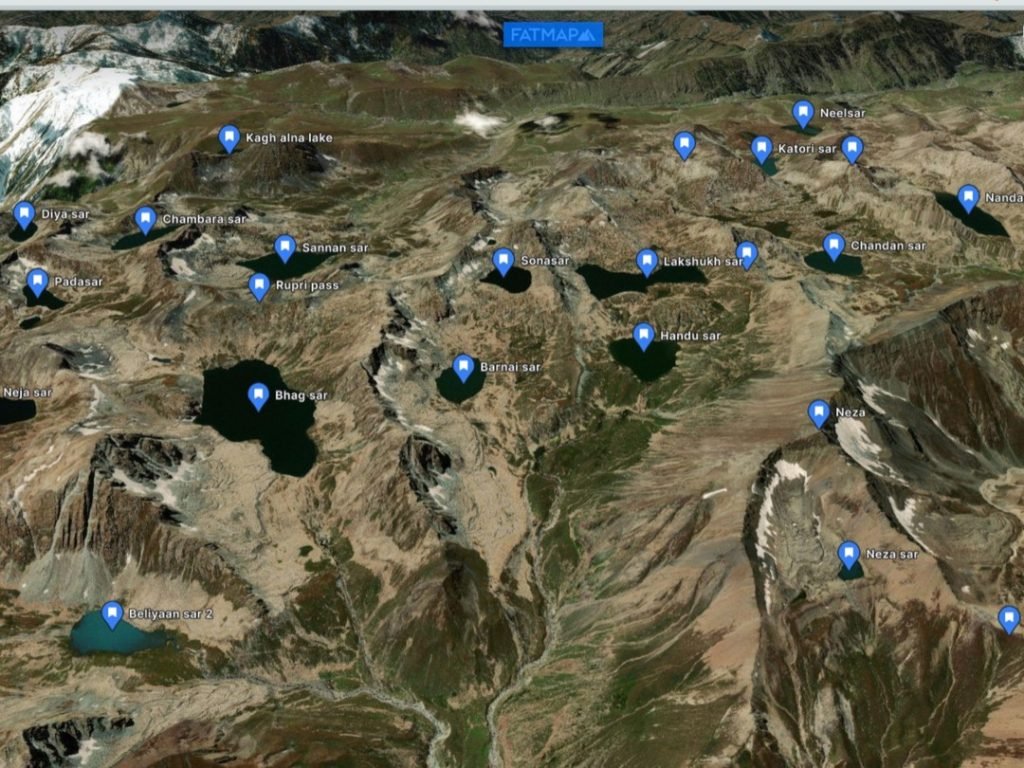
Hirpora Lakes Trek (21 lakes)
Total distance: 70kms
Difficulty level: Moderate to Difficult
Start point: Dungimarg Mughal road or Pir Ki Gali
Best time: July to Sept
It is a multi-day trek where one explores about 21 alpine lakes. The route is challenging and one needs to go with proper planning in order t explore all the lakes in one go. Some of the lakes include Chandan Sar, Nandar Sar, Katori Sar, Bhagsar, Dhakiar Sar, etc.
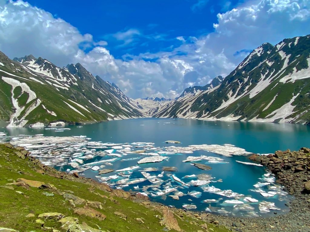
Kausarnag
Distance: 17km (one side)
Difficulty level: Moderate to Difficult
Start point: Aharbal Kulgam
Ascent: 1300m
Best time: July to Sept
Kausarnag is the second largest alpine lake of Kashmir valley at an altitude of 3400m. The trail starts from Aharbal Kulgam and follows the course of the stream. Near the Sangam, where two streams meet, the trail bifurcates. If you want o continue through Kongwattan meadows then take the left one and if you want to skip then take the other one. Both these trails meet at the Mahinag. It is also a multi-day trek but some hikers who are very fit physically, complete this trek in a single day. So if you are planning a multi-day trek to Kausarnag then you can either camp at Kongwattan or at Mahinag.
From Mahinag follow the trail and turn SE after some km. The last portion of the trail is steep and challenging but it is worth once you get a first view of the Lake from there.
Indersar
Indersar Lake is at an altitude of 3900m near Astanmarg Pir Panjal Range. It can be approached from two sides. One is from the Aharbal side and the other is from the Halan Kulgam side.
Aharbal route:
Aharbal to Mahinag and turn East there. From Mahinag it is a 1000m of steep climb up to the Lake.
Halan route:
Halan to Chiranbal to Kachahoi and then to Indersar Lake.
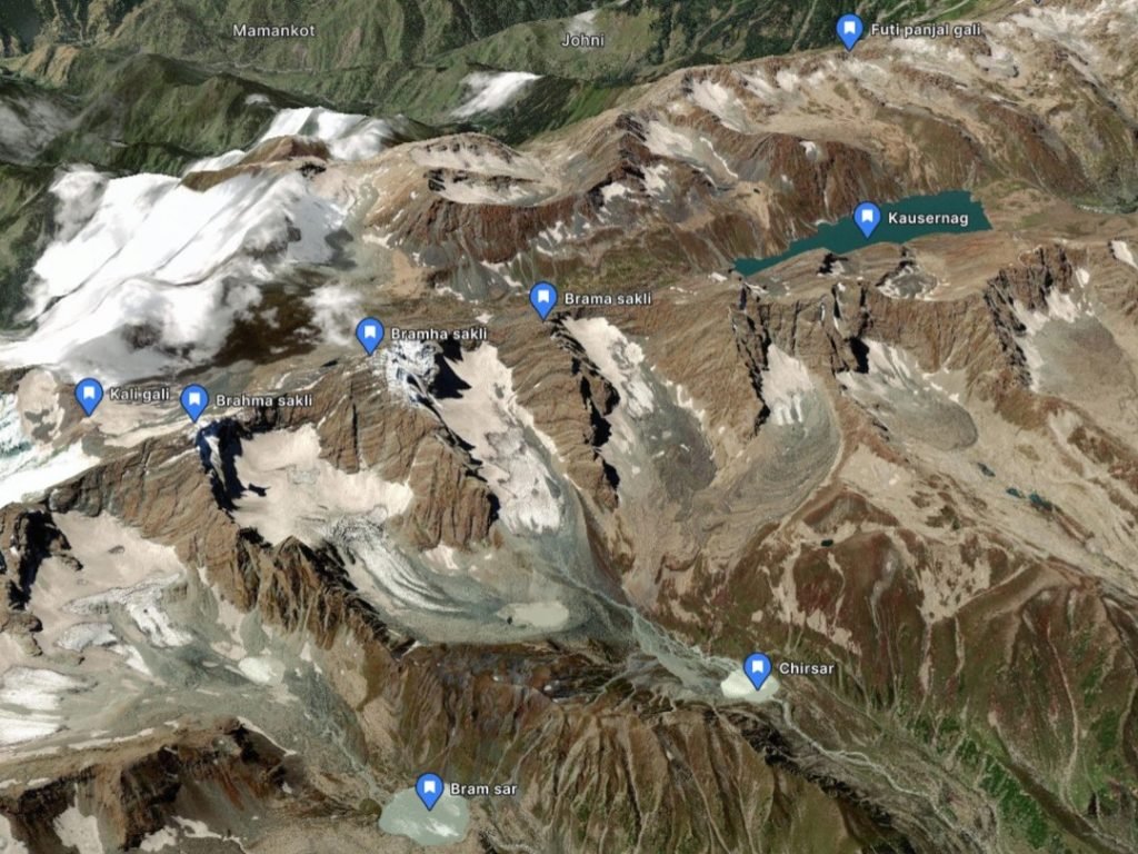
Chirsar and Bramsar
These 2 lakes lie in the Kulgam district of Kashmir valley at the northern foothills of Brama Sakli peaks. Above both of these lakes lie small glacial water bodies which are now big enough and possess a great threat of GLOF.
Chirsar is a 24km trek from Halan Kulgam with an elevation gain of 1300m while Bramsar is a 28 km trek from the same place with an elevation gain of 1400m. Both of these treks can be done in a single day if one is fit enough otherwise one night two day is enough to explore these picturesque alpine lakes. The difficulty level is between moderate and difficult.
Conclusion:
Alpine lakes are among the many natural wonders on our planet. As the demand for outdoor recreation increases, it is essential to preserve these precious resources for future generations to enjoy. With proper management and protection, alpine lakes will continue to be among the most stunning jewels of our planet.
")